High-Precision Aerial Survey Drone – Military-Grade Accuracy for Mapping & Inspections
Advanced Unmanned Aerial System for GIS, Mapping, and Industrial Inspection
Core Technologies
- RTK+PPK Dual Positioning: 1cm absolute accuracy without ground control points
- Multisensor Payload Integration: Switch between LiDAR (600 pts/m²), 42MP RGB, and 5-band multispectral
- AI-Optimized Flight Control: Autonomous terrain following and obstacle avoidance
- 90-Minute Flight Duration: 500+ hectare coverage per sortie
Technical Benchmarking
| Specification | Moneypro SP-900 | Industry Standard |
|---|---|---|
| Positioning Accuracy | 1cm RTK/PPK | 3-5cm GPS |
| LiDAR Density | 600 pts/m² | 200-300 pts/m² |
| Max Coverage/Sortie | 500 ha | 150-250 ha |
| Operating Temperature | -20°C to 50°C | 0°C to 40°C |
Cutting-Edge Technologies
Military-Derived Positioning Systems
Adapted from PLA reconnaissance drones, featuring:
- Anti-jamming GNSS receivers for urban/industrial environments
- All-weather operational capability (IP54 waterproofing)
AI-Enhanced Data Processing
- Real-time quality control during flights
- Automated point cloud cleaning reduces manual work by 70%
- Direct CAD/BIM export compatibility
Next-Gen Sensor Fusion
- Simultaneous LiDAR + RGB data acquisition
- Hyperspectral imaging options for precision agriculture
Key Market Applications
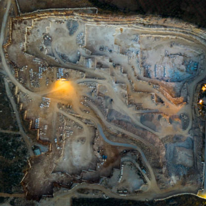
Surveying & Mapping
- Cadastral mapping at 1:500 scale
- Mining volume calculations with 98% accuracy
- Rail and road corridor mapping
Construction & Engineering
- As-built verification against BIM models
- Infrastructure inspection (bridges, dams, power lines)
- Stockpile volumetric analysis
Agriculture & Environment
- Crop health monitoring via NDVI/NDRE
- Forestry inventory management
- Flood risk assessment modeling
Emerging Applications
- Solar farm performance auditing
- Urban 3D modeling for smart cities
- Disaster zone assessment
Operational Advantages
Productivity Gains
- 5x faster data collection vs ground survey teams
- 60% reduction in project costs per hectare
Case Study: Highway Construction
| Method | Time Required | Cost per 10km | Accuracy |
|---|---|---|---|
| Traditional Survey | 21 days | $38,000 | ±5cm |
| SP-900 Drone | 2 days | $6,500 | ±1cm |
Competitive Differentiation
Technical Superiority
- Centimeter accuracy without ground control
- Military-grade durability in harsh conditions
Workflow Integration
- Direct export to AutoCAD, Revit, ArcGIS
- Custom SDK for enterprise software integration
Service & Support
- On-site calibration services
- Dedicated technical support team